|
Group 4: Urban planning in downtown Toronto:
A lesson for Hong Kong
Hong Kong, being one of the most rapidly developed city in the previous decays, has become a well-known international financial center. However, it was said that because of its rapid development, there are insufficient planning in the urban area and has resulted in many social problems. After investigating the urban planning in Toronto, is there anything the Hong Kong can learn from this well-developed Canadian city? What are the differences between the urban planning of Toronto and Hong Kong?
We will be investigating the above in four areas:
-
Neighbourhood at Spdina Avenue and Willcocks
-
St. Lawerence Market at King Street and Front Street
-
The Financial District at King Street and Bay Street
-
The King-Spadina Manufacturing District.
|
Neighbourhood at Spdina Avenue and Willcocks
According to the Official Plan for the City of Toronto, three-quarters of the city’s area is used for neighbourhoods, parks, ravines, watercourses and valley. One of the factors that Toronto attracts people to live and work there is the variety and quality of the residential community, Neighbourhoods.
Neighbourhood is a well-planned and protected place connecting people to develop a common sense of community. There are hundreds of neighbourhoods containing low-rise residential buildings, parks, schools, local institutions and small-scale stores in Toronto. In 1950-1970, there were many high-rise offices, institutions ad residential buildings constructed in the midst of low-scale residential neighbourhoods. However, after 1976, there was a change in spatial pattern. No more new high-rise buildings are allowed to be built in the neighbourhoods. Hence, the neighbourhoods are protected.
Nowadays, as the economy has changed, people have begun to work at home. This reduces trips to works and enhances safety. These home occupations help to provide a sense of neighbourhood. Besides, educational land use has been added in neighbourhoods. This integration of neighbourhoods and schools help to ensure the quality of life. The stability of the physical character of neighbourhoods is one of the keys to Toronto’s success. Under the policies of the Official Plan, there are three major elements in neighbourhoods.

First, it is to maintain buildings in low-rise in neighbourhoods. Neighbourhoods are considered as physically stable areas made up of low-rise residential buildings which include detached houses, duplexes, triplexes and walk-u
apartments that are four-storey or less. Besides, parks, low-rise local institutions, home occupations, cultural and recreational facilities and small-scale retail, service and office uses are also provided in neighbourhoods. In neighbourhoods, the low-rise local institutions play an important role of the daily life in neighbourhoods. They includes, schools, place of worship, community centres, libraries, day nurseries and private home daycare, seniors and nursing homes and long-term care facilities, public transit facilities, utility and telecommunications installations and public services.
Second, it is to protect the character and reinforce the stability of the neighbourhoods. At the boundary points between neighbourhoods and growth areas with mixed land use, there should be a transition in height, scale and density provided. It helps to protect the neighbourhoods not to be affected by nearby land use. Therefore, the mixed land use can be compatible with the neighbourhoods. Also, to attenuate traffic and parking impacts on adjacent neighbourhoods streets. This can reduce the diminishing on the residential amenity of those neighbourhoods.
The third element is to improve and enhance the living environment and infrastructure of neighbourhoods. To provide adequate privacy, sunlight and sky views for residents of new and existing neighbourhoods. There should be enough space and distance between building walls. On newly created or existing public streets, there should be no gates limiting public access. It should locate and screen service areas and garbage storage in order to minimize the impacts on existing and new neighbourhoods.
Moreover, maintaining roads and sidewalks in a good condition. Improving and expanding existing parks, recreational facilities, libraries, local institutions, local bus and streetcar services for neighbourhoods residents. Discouraging parking on local street for non-residential purposes. And, creating new community facilities and local institutions, and adapting existing service to changes in the social, health and recreational needs of the neighbourhoods.
Therefore, there are a lot of benefits living in neighbourhoods. There is better transit service. This can reduce reliance on private automobile. There are greater hosing choices, increased shopping opportunity and improved pedestrians environment.
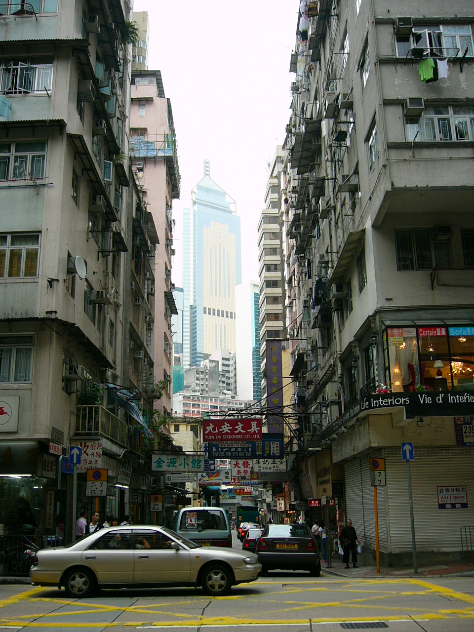
Comparing with residential area in Hong Kong, there is no neighbourhood. It is because land is limited in Hong Kong. It is difficult to develop low-rise residential area with spacious parks. Most of the residential buildings in Hong Kong are over 30 storeys. And they are very to each other. Therefore, the privacy, sunlight and sky views of the residents are hardly be guaranteed in Hong Kong
However, there are many public estates in Hong Kong which have the same functions of the neighbourhoods in Toronto. In most of the public estates, there are shops, market, community centres, schools and playgrounds. This can give a sense of community to residents. The difference is that Hong Kong has a smaller scale than Toronto. Besides, the transportation network of public estates in Hong Kong is well-developed. There are bus, taxi, mini-bus and railway near the estates. Same as the neighbourhoods in Toronto, the accessibility is very high to the residents.
|
|
| |
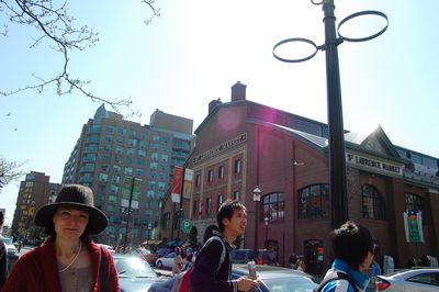
St. Lawerence Market at King Street and Front Street
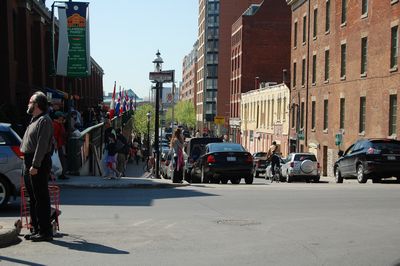
The St. Lawrence Market at King Street and Front Street gained its name mainly from the well-known waterway of the northeast Canada, The St. Lawrence Seaway. In the past, the seaway largely supported the long distance trade of all kinds of goods, including raw materials and textile. The St. Lawrence Seaway was officially opened in 1959, and has served 40% of the YS manufacturing and half of the production of US soybeans and corn (Digital Wizards Inc., 2007). Its vibrant activity in long distance trade can be observed by the establishment of the banking and financial activities nearby.
In the area around the St. Lawrence Market, a design of a ‘community’ can be found. The St. Lawrence Market was commonly considered as a design to serve the purpose to retain the local neighbourhood. As mentioned in the previous sections, neighbourhood is one of the main considerations in the process of town planning in Toronto, so that a common sense of community can be developed. The St. Lawrence neighourhood was initiated to respond to ‘the changes made in federal, provincial and municipal housing policies in the early 1970s’ (CEDRO, 2001). In the area, there are provisions of all kinds of essential social facilities and amenities. For example, there we can find performing centers like the St. Lawrence Centre for Performing Arts, waterfront recreation, schools, hospitals and public transit.
The reason for such a ‘community’ being designated here is because of the fact that the area is very near to the downtown adjacently, and since large part of the land was previously in the hands of the public sector, it was easy to be assembled for development. Hoping to create a type of neighbourhood that was ‘affordable, centrally located and is controlled by residents’ (CEDRO, 2001), the planners and working committees tried to plan the area with a high degree of openness, and encouraged community participation. This helped avoiding government-dictated form of planning that was often found in the past, which in fact failed the aim of creating an area for whom that are really using it and living there.
We can see that in the area around the St. Lawrence Market, people from differentiated range of income, social class, age and household size settled. This has created a mixture of people from different social background and set as an ‘origin’ of how social cohesion was enhanced in the area, which is near to the downtown.
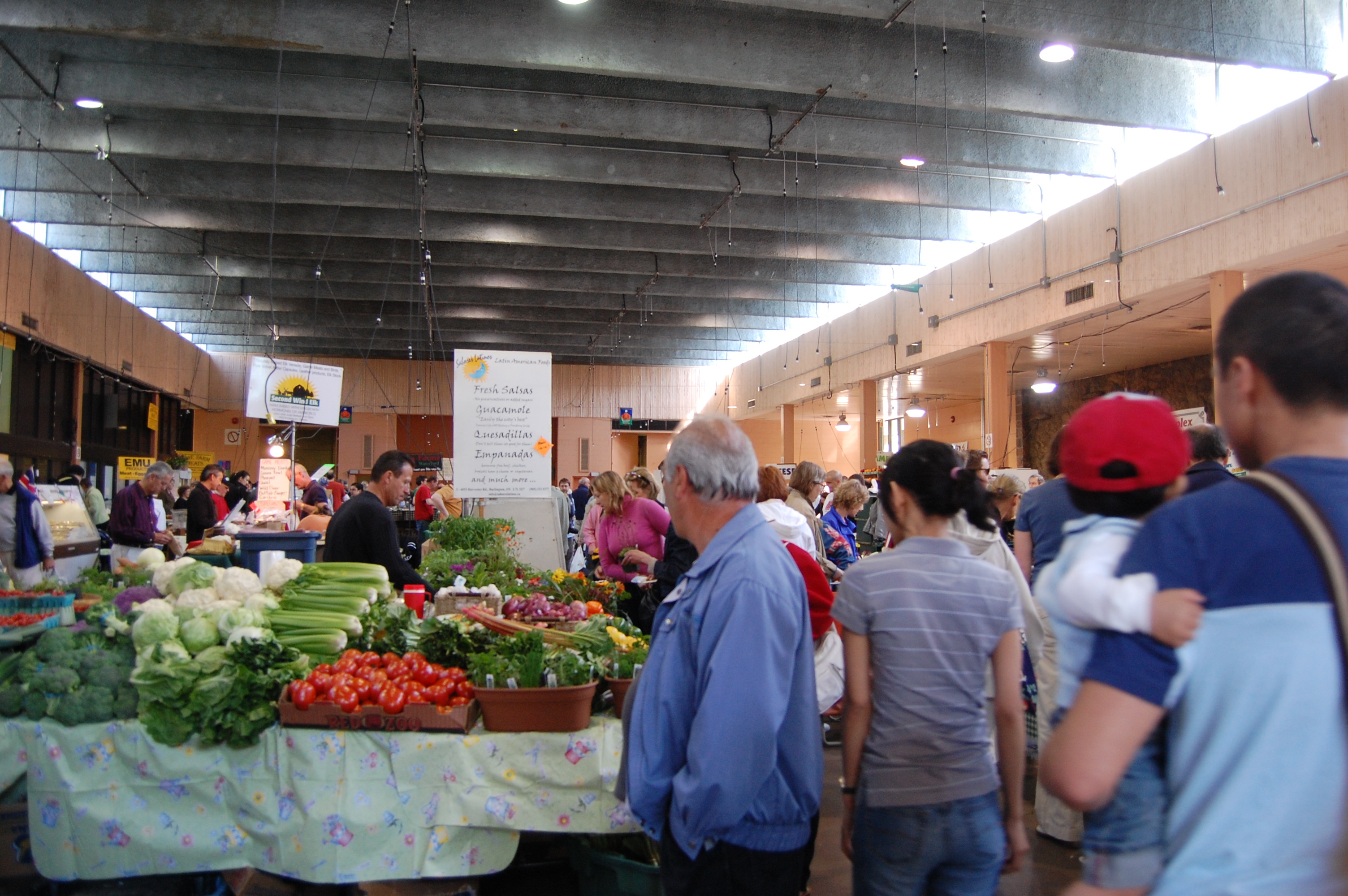
Apart from that, the St. Lawrence area is also considered as a social gathering place. As described by Professor Gad, the St. Lawrence Market is a place with social cohesion and gathering taking place. It was said that such gathering was not only limited to the getting-together of a particular social group (e.g. only farmers getting together on the Saturday Farmers’ Market), but a place where people from different group and different social strata get together. This includes the intellectuals, common citizens and also farmers. This is especially true on the weekend, where many citizens are off from work. So, they can go to the place with their family, buying fresh food sold by the farmers, spending some time relaxing and socializing with the others. Serving as a social gathering place enhancing cohesion among different social groups, it created a network among the local people.

Another feature we can notice in the area is the provision of protected walkway. This was also a part of the planning. These protected walkways were created next to the shops located at the ground floor, and were aimed to protect the pedestrians from the snow storms in the winter, while they can walk under the warm sunshine in the summer. However, such protected walkway was commented as a feature that favours only the pedestrians but not the shopkeepers. This is because such provision has somehow prevented the customers from getting into the shops to do some shopping.
In the area around the St. Lawrence Market, there is also the existence of a visual corridor. A visual corridor means that the people in the place are capable of viewing the area even at a far distance. Such visual corridor implies that there must be the construction of low-rise settlement in the area. This is important, because according to the urban development plan, it hoped to allow the public to get close to the waterway and allowing them to get close to nature. So, the public reach the sea visually and physically in a short distance and in a straight road due to the design of a neat street grid system.
Another purpose of the creation of a visual corridor is that, this allows the public from viewing the church from every corner in the downtown. This shows the importance of the church and the old church building in the area, which is said to be the forerunner of the existing church.
Apart from that, there are also some wholesale buildings in the area. They were 3-story high and have been renewed in the recent years due to the development plan. This is because in the past, as mentioned, the St. Lawrence area was famous for its manufacturing and wholesale. After the decline of the manufacturing industry, the old buildings were now being turned into warehouses. These buildings were old and are considered to have historical value. So in 1970, the government has passed the Heritage Act to preserve the buildings in the area.
When we compare the St. Lawrence Market with similar cases in Hong Kong, it is indeed quite hard to find an example to compare it with. This is because in Hong Kong, we seldom find a place that is serving both as a market place and most importantly, a place that enhance social cohesion. Indeed, in the past, the wet market may somehow serve such purpose to some extent, that although they are mainly selling fresh foods, we can still find some degree of social cohesion on going. For example, at the top floor of the wet market, there are some low-priced restaurants where we may find some people (mainly from the lower strata of the society) get together. However, nowadays, with the opening of large scale supermarkets, like Wellcome and Parknshop, many local people now turn to these branches for buying fresh food because of the more hygienic condition. This in the end has diminished the significance of the local wet markets, and symbolically, Hong Kong is losing a similar icon of social cohesion like that of the St. Lawrence Market in Toronto.
|
Reference
CEDRO, University of Calgary (2001) Directions for New Urban Neighbourhoods:
Learning from St. Lawrence. Retrieved 5 July, 2007 from the World Wide Web www.ucalgary.ca/EV/designresearch/projects/2001/CEDRO/cedro/cip_acupp_css/index.html
City of Toronto. (2006). King-Spadina Secondary Plan Review. Retrieved on 28 June 2007, from the World Wide Web: http://www.toronto.ca/planning/king_spadina.htm
City of Toronto. (2007). Official Plan for the City of Toronto. Retrieved on 2 July, 2007, from the World Wide Web: http://www.toronto.ca/planning/official_plan/pdf_chapter1-5/chapter1-5_searchable_locked.pdf
City of Toronto (2007) The St. Lawrence Market. Retrieved from the World Wide Web
http://www.stlawrencemarket.com/
Digital Wizards Inc. (2007) The St. Lawrence Seaway: Economic Engine of the
Northeast. Retrieved 5 July, 2007 from the World Wide Web
http://www.greatcanadianrivers.com/rivers/stlawer/economy-home.html
Gad, Gunter. (1999). Downtown Montreal and Toronto: Distinct Places with Much in Common. Canadian Journal of Regional Science, 22(1), 143-170.
Gad, Gunter. (2007). Introduction to Toronto: A walking tour. Toronto: Department of Geography, University of Toronto.
Hill, Sharon. (2006). King-Spadina Study, King-Spadina.com. Retrieved on 28 June 2007, from the World Wide Web: http://www.king-spadina.com/firstStep.html
Urban Renewal Authority. (2007). Kwun Tong Town Centre Project. Retrieved on 28 June 2007, from the World Wide Web: http://www.ura.org.hk/html/c800000e33e.html
Vinodrai, Tara. (2001). A Tale of Three Cities: The Dynamics of Manufacturing in Toronto, Montreal and Vancouver, 1976-1997. Ottawa: Statistics Canada.
|
|